Defra launches interactive map of bird flu mortality in wild birds

The Department for Environment, Food and Rural Affairs (Defra) has launched a new interactive map of reported wild bird mortality and findings of avian influenza in wild birds and wild mammals.
The department has also launched an interactive dashboard allowing the public to explore findings of bird flu in wild birds from the Animal and Plant Health Agency's (APHA) surveillance programme.
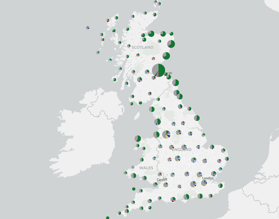
The map and dashboard will be updated weekly, the department said. Collection information and test results may show as pending for recent reports.
Anyone wishing to view the map can customise it by selecting from the layer list which map elements they want to display.
A time slider can also be used to display data from a selected time period.
Bird flu in wild birds
Defra has practical information to support land managers, the public, and ornithological and environmental organisations in their response to the growing threat of bird flu.
The mitigation strategy for bird flu in wild birds in England and Wales explains how these groups, together with the government and its delivery partners, can reduce the impact on wild bird populations whilst protecting public health, the wider environment and the rural economy.
Landowners, local authorities and other organisations are advised to download and print bird flu posters to display on site when there is a risk of bird flu, or if bird flu has been detected in the area.
Dead wild birds can be reported via Defra's website.
Kept birds
In the UK there were 207 confirmed cases of highly pathogenic avian influenza H5N1 strain in the 2022 to 2023 outbreak season:
There have been 294 cases of the H5N1 strain of bird flu in England since the outbreak started in October 2021.