GPS trackers fitted to Mournes sheep to aid burn area recovery
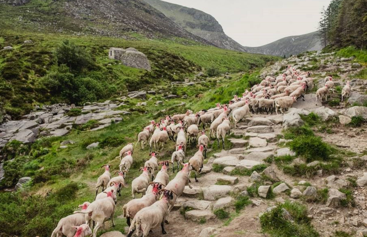
GPS trackers for sheep, drones and special test areas will all form part of the arsenal of agri-technology used to aid the Mourne Mountains wildfire area with its recovery.
In April, a major wildfire destroyed around 200ha of forest, gorse and bog on Slieve Donard, one of Northern Ireland's most treasured Special Areas of Conservation.
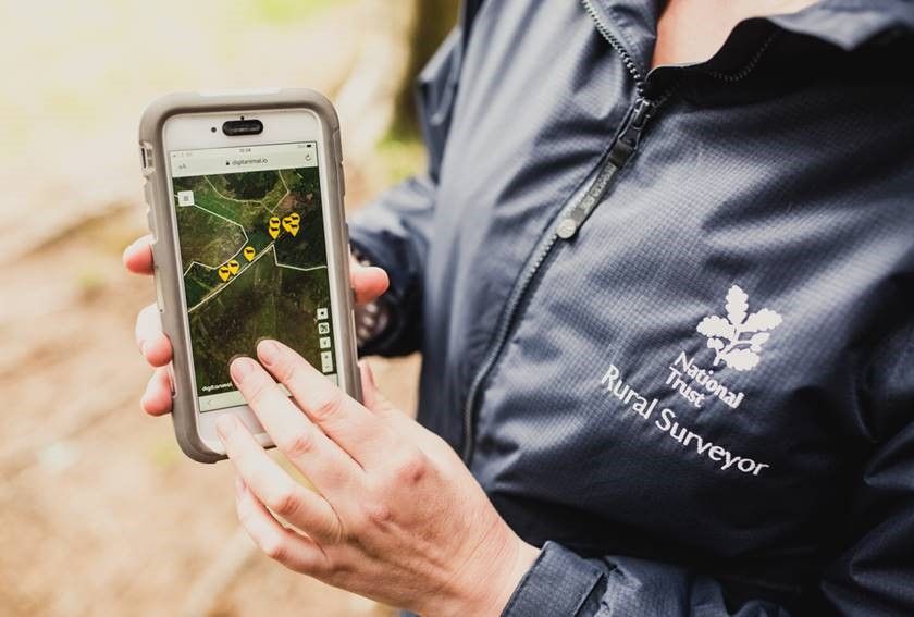
Along with drone imagery, habitat monitoring and control sites, the devices will provide valuable data on any impact of grazing and allow the land to be managed for optimal recovery.
Rhona Irvine, rural surveyor for the National Trust, said: “Light conservation grazing by sheep helps to prevent dominance from individual, more invasive species, as well as reducing the number of woody shrubs.
“Faced with the problem of how to control the livestock in a landscape which would be impossible to fence or compartmentalise, we came up with an innovative solution.
“We are fitting ergonomic GPS tracking collars on a proportion of the flock which will be regularly recording the position of the animals. This information will be relayed back to an app which can be used to assess whether any action needs to be taken to heft the sheep on to different areas of the mountain.”
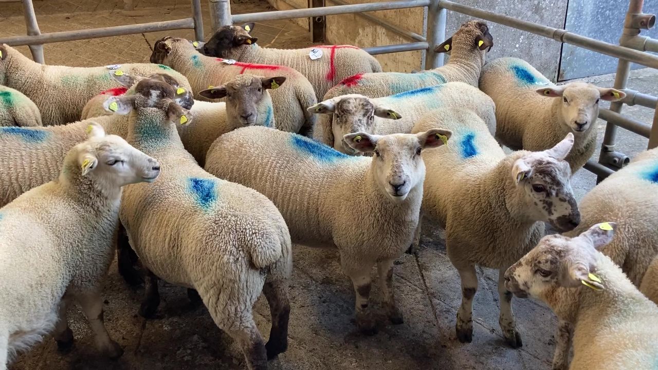
Sheep farmer John Maginn, who owns the flock, said he would use the technology alongside some traditional farming methods: “This new technology is bringing us into the 21st Century.
“If we do decide that the sheep need to be moved on to a different area, we will resort to the old-fashioned method of using sheepdogs to heft the flock onto new pasture.
"Our family has been farming in the mountains for many years and it’s great to see money being spent on technology that will make our job easier and more efficient, though we will always continue to rely on the sheepdogs to do what they do best."
How it works
10% of the flock have been fitted with the tracking collars and there is the option of additional Bluetooth eartags.
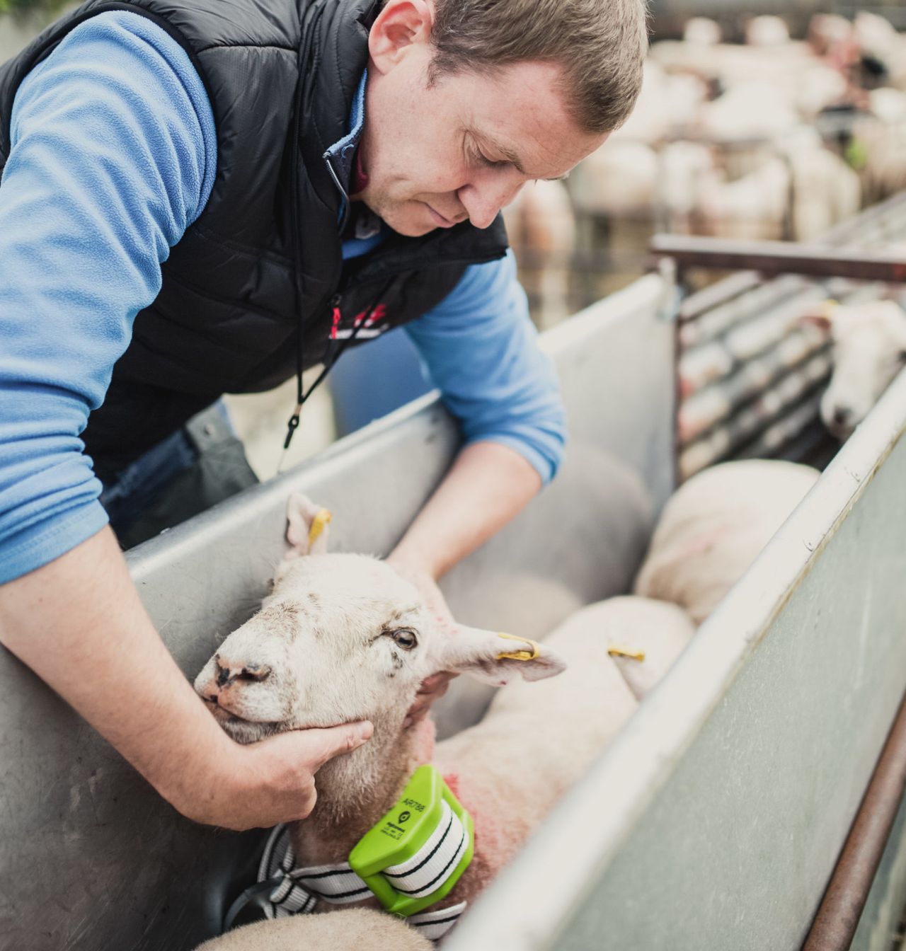
The collars will track the sheep movements continually, sending a ‘ping’ every 15 minutes, and alerts to the farmer about their activity levels and even their temperature.
The sheep will wear them until they come back down to lower ground in the autumn.
Data from the trackers will be overlayed with location maps of the sheep to see whether they are spending long periods grazing the new growth as it emerges in the burnt areas.
The collars cost just over £3,000 and are funded by the National Trust’s Farming Innovation Fund.
The trust ran the first trials in the world of GPS virtual fencing technology when cattle were re-introduced to the heath at Studland Bay in Dorset.
Irvine explained the data collected would help inform the trust's future land management practices.
“Along with drone imagery, habitat monitoring and control sites, the devices will provide valuable data on any impact of grazing and allow us to ensure we are making good decisions for the optimal recovery of the land," she said.
“Our aim is to ensure the mountain gets back to full health as soon as possible for the animals and invertebrates that live there, but also for the many people who love, care for and visit this special place.”